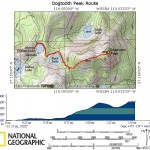
Dogtooth Peak & Sisters Peaks - Dinkey Lakes, Sierra National Forest
All the neat things to see are pretty close on this trip, so not a lot of mileage to cover. But lots of time can be sent here exploring, rock climbing, swimming, fishing, and hiking. I organized this particular trip for all of that, with the intent of taking my smaller children and avoiding the heavy miles.
Contact
- Prather Ranger Station
- 559-855-5360
Wilderness Permit
- http://www.fs.fed.us/r5/sierra/passes/wilderness-reservation-form.pdf
- Willow Meadow Trail are entrance and exit trails
- http://www.fs.fed.us/r5/sierra/recreation/wilderness/trailheads/dinkey/willow.shtml
Trail Head
- N 37° 9' 5.66"
- W 119° 6' 15.42"
Directions
- Hwy 168 into Shaver Lake
- Turn right on Dinkey Creek Rd. This is a well maintained road
- Go 9 miles, turn left on 9S09. This road is sort of paved, with large pot holes
- Go 7 miles, turn right on 9S10. This road is broken dirt and paved, pretty bad shape
- Go 4 miles, SHARP right turn on 9S62, a pure dirt road. This leads to a large parking area where the trail head is.
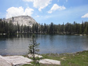
Swede Lake


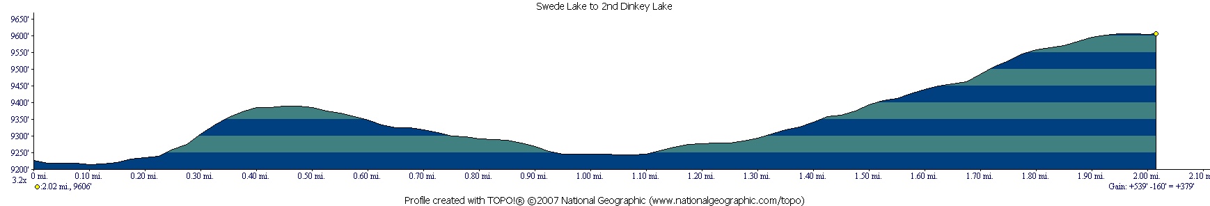
2nd Dinkey Lake
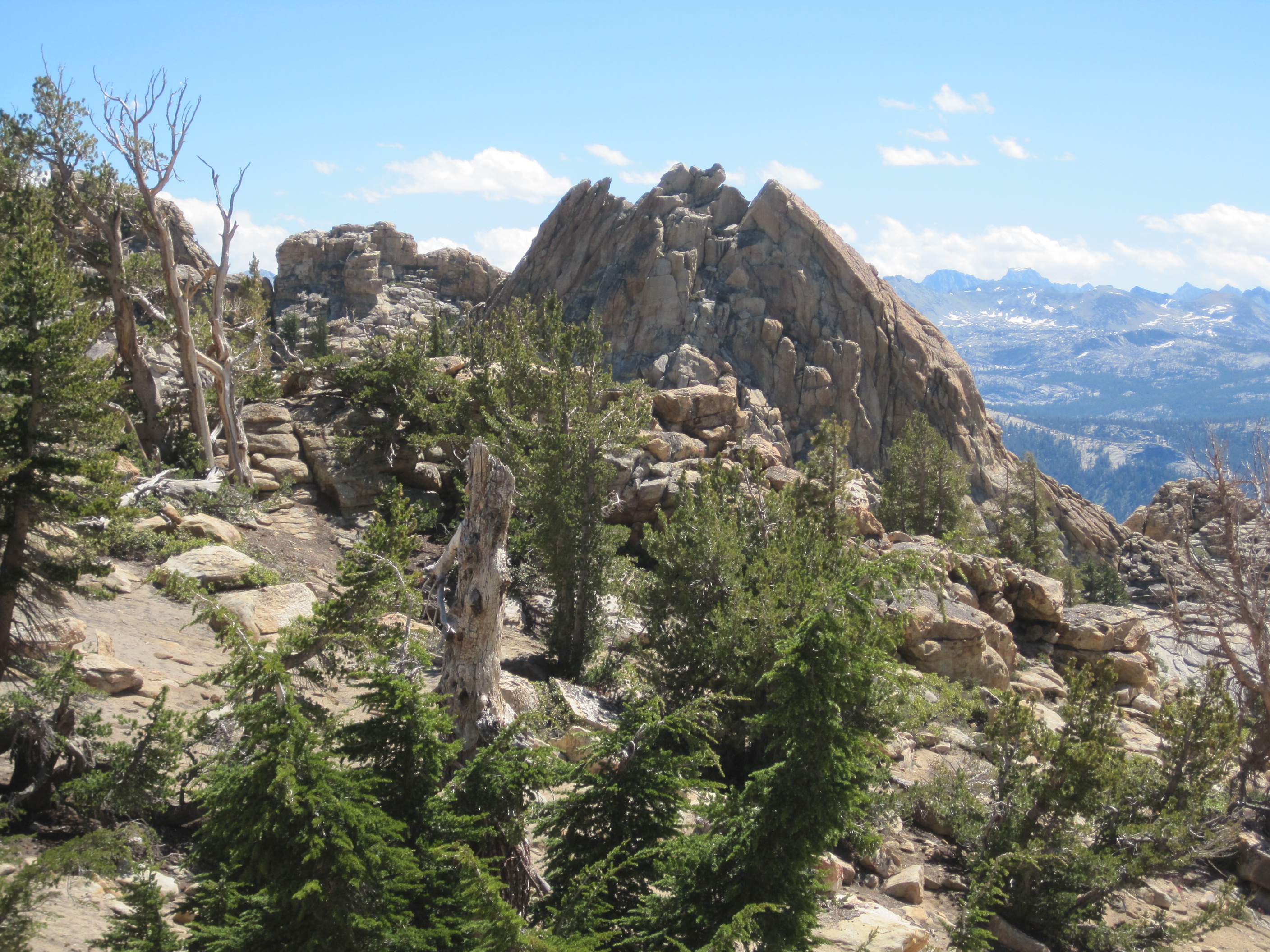
Dogtooth Peak
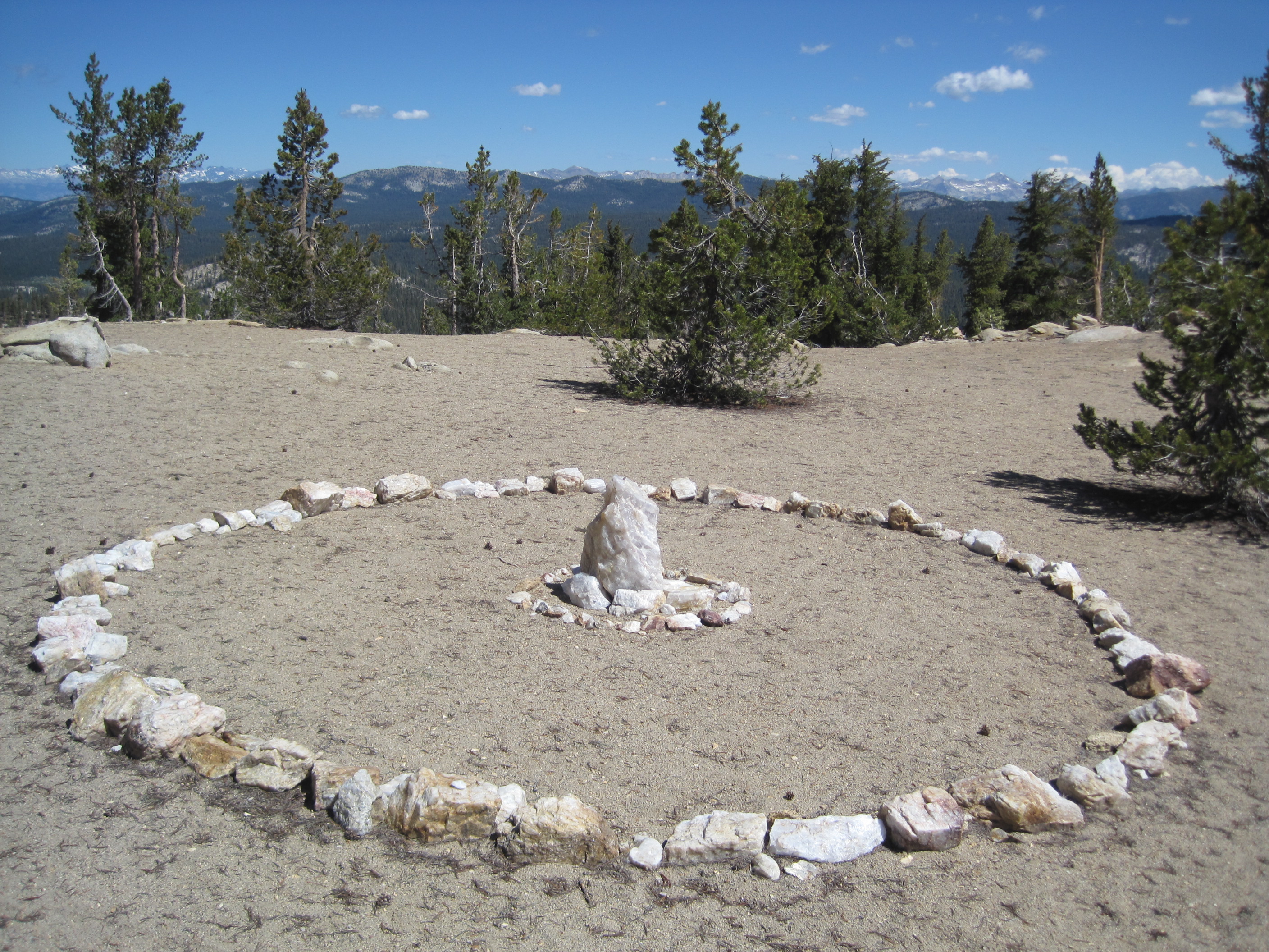
 trail. As you approach the saddle in the pass, bear east and hike to the top of the first peak. There is an interesting circle made of quarts on the top and a nice place to take a breather. Drop down that little saddle and make your approach towards Dogtooth peak. There is a bit of a rock scramble but its fairly easy to summit and no special equipment is needed to get to the top.
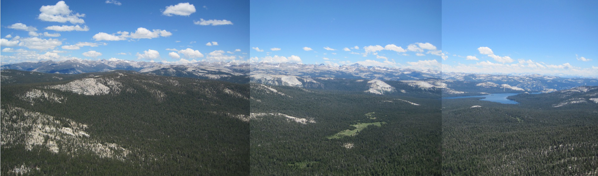
Island Lake
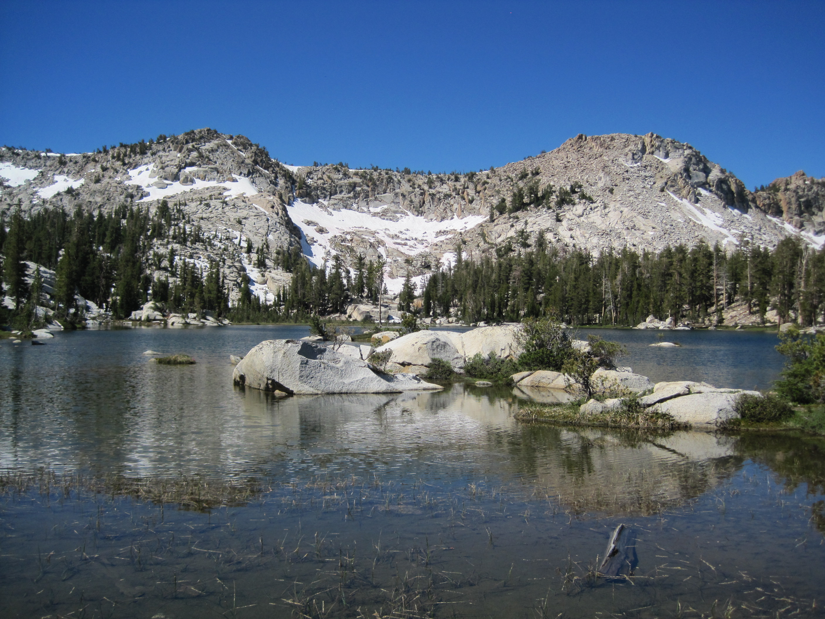
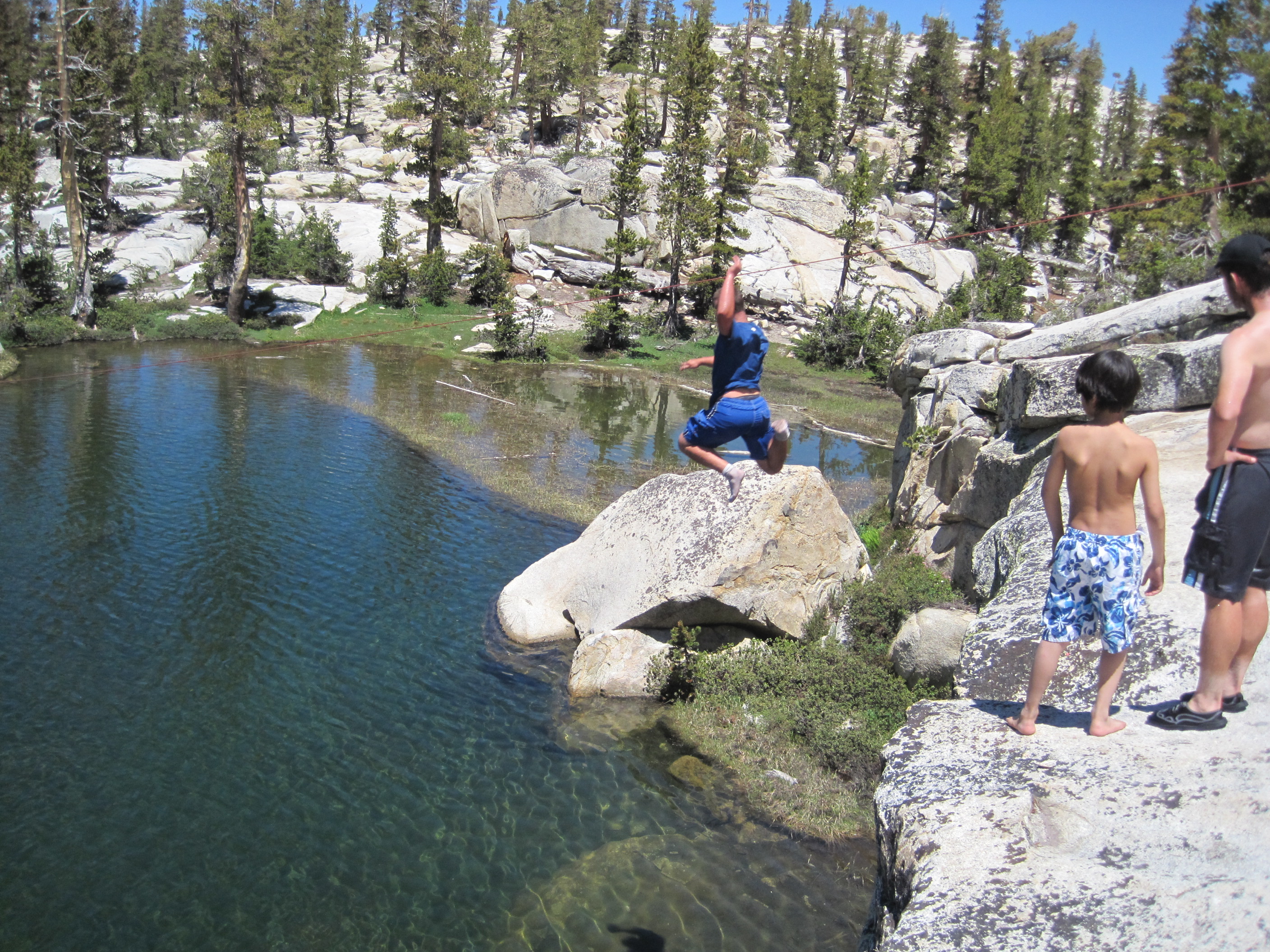 This is a 1/2 mile hike from 2nd Dinkey Lake to Island Lake. It climbs up about 200' in elevation and puts you at the base of the 3 Sisters peaks. The fishing in this lake seems to be especially awesome in the mornings and in the evenings. I feel like a fly and a bobber are the best bet. Also, to the immediate left of the crest when you first arrive at the lake is a hidden campsite. Right below it is quite a nice jump into the lake (about 20' drop).
3 Sisters Peaks
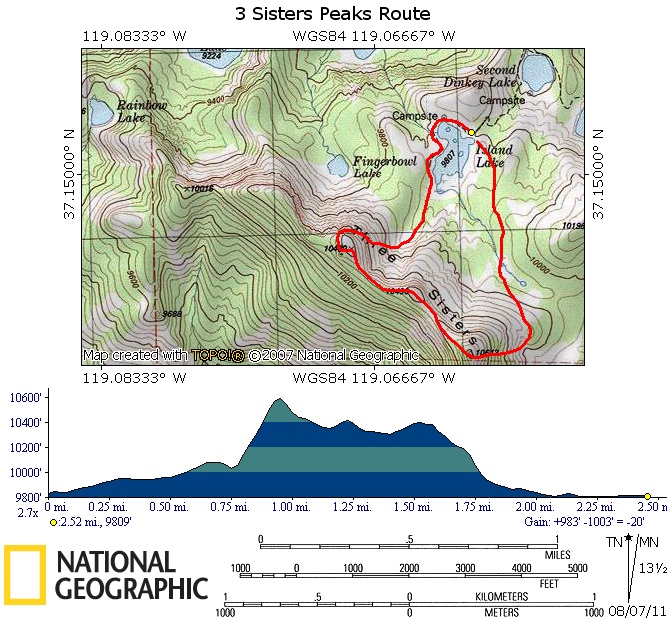 Go up the highest of the 3 sisters from the tree line on the south side. It seems to be the smoothest approach. Continue through the Middle Sister on to the last Sister Peak. There is a canister to sign on the first and last Sister. The descent from the last Sister seems to be best from the north side dropping down into a little tree area which starts a smooth descent sometimes covered in snow. We slid down the snow :)